For more than 10 years, Hanson has provided outdoor advertising sign control services for the Illinois Department of Transportation’s (IDOT) Bureau of Land Acquisition across more than 14,700 miles of roadways in Illinois, with an estimated 12,800 signs. In addition, Hanson has provided an inventory list for approximately 1,200 salvage yards.
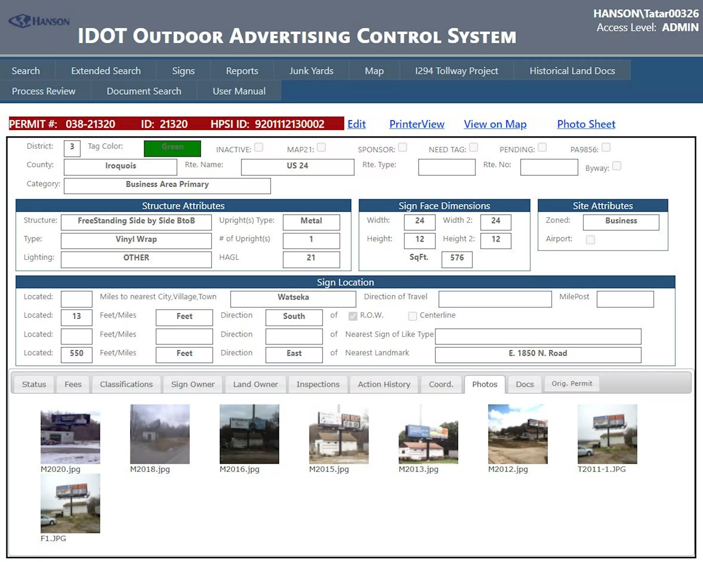
Control services include an inventory of all signs within IDOT control every two years; a massive data collection effort, involving sorting, scanning and entering data into IDOT’s Outdoor Advertising Control System (OACS) geographic information system (GIS) database; a statewide processing of sign permit applications; and continual surveillance activities — including illegal sign control mitigation efforts — for all of Illinois’ controlled route network.
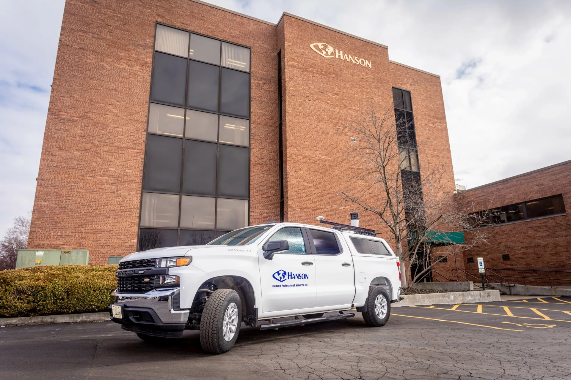
Using the latest mobile and data collection technology, Hanson’s staff is covering the controlled routes in Illinois to provide the documentation process necessary for collecting the required information. One of the most notable aspects of the data collection process is Trimble’s mobile data capture system — a complex unit attached to a survey vehicle that includes cameras, GPS and geospatial components.
This unit collects the field information and can cover approximately 300 miles per day. The mobile data capture system uses a combination of high-resolution imaging, a global navigation satellite system and inertial positioning, along with a multiplexer, to synchronize data and capture sign dimensions, position, digital imagery and latitude and longitude with GIS mapping-grade accuracy while the vehicle travels at highway speeds. The data is then seamlessly processed in the IDOT OACS system. This mobile method of data collection is safer and more efficient than people working on foot in and around roadways.
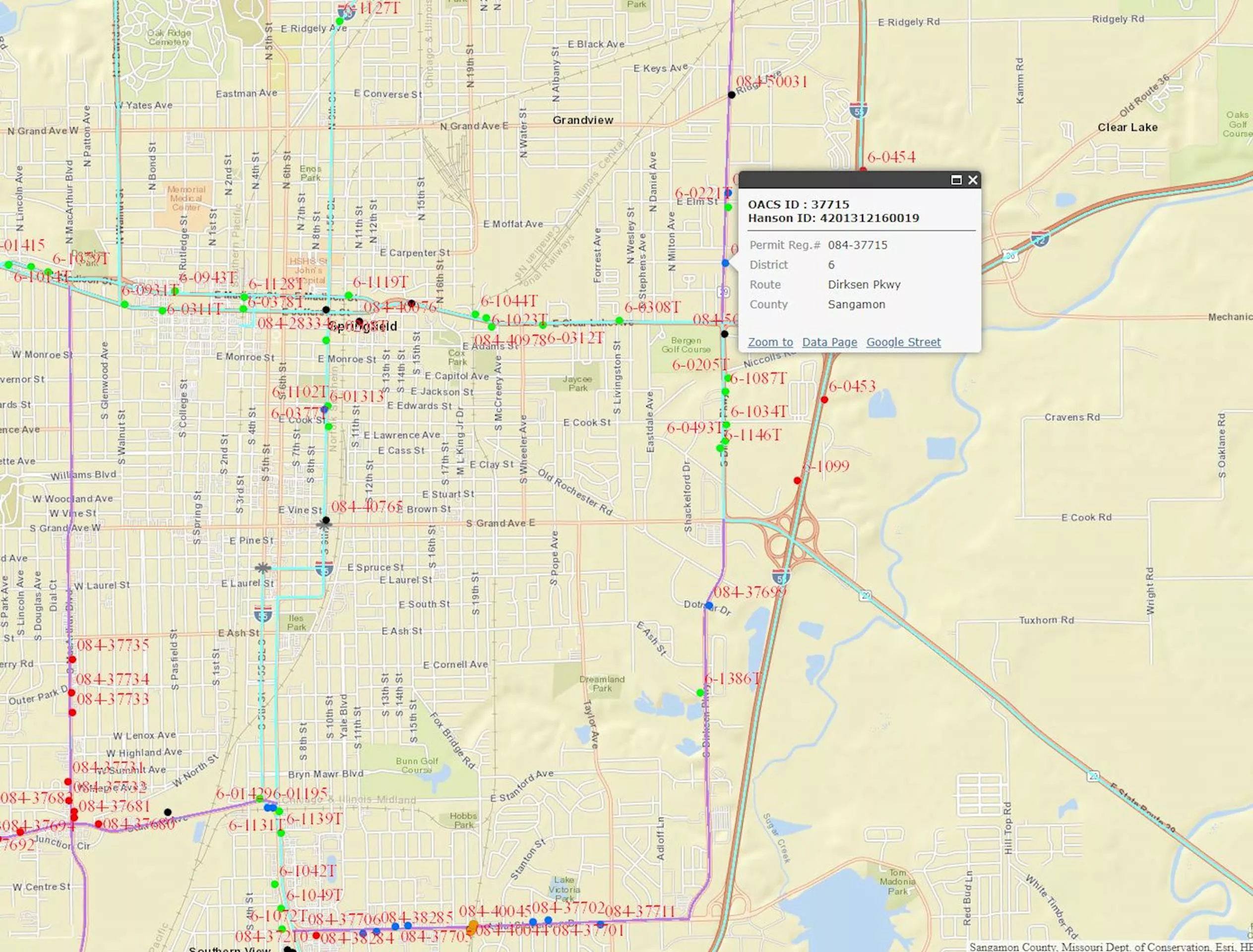
Hanson has developed and maintained a GIS web-enabled, controlled route mapping application system that provides easy access for searching and navigating the vast sign inventory and is linked to the OACS database. This system also provides a comprehensive means for project status reporting, data review and workflow management. Additionally, various controlled route map layers that depict business areas, urban area limits, municipal boundaries, airport clear zones and scenic byways are developed and included in the system application. Hanson is assisting IDOT with migrating the sign data into its new data management system, which will allow applicants to apply for sign permits and pay application fees online.