Vero Beach Regional Airport is a dynamic, general aviation airfield with a mission of supporting its surrounding communities’ economic sustainability. In 2016, the city of Vero Beach drafted a master plan to map the airport’s path to a more vibrant role in the future growth of Indian River County and the surrounding region along Florida’s eastern coast.
The airport determined that expanding its Taxiway E ramp would be a critical part of its future. Hanson has partnered with the airfield’s leadership for several projects, and Vero Beach also chose us to provide design and permitting services for phases 1 and 2 of the taxiway expansion. The project involved extending the taxiway ramp west, grading the area north of the ramp in preparation for hangar development and rerouting the taxiway’s north ditch and adding water control structures. Our role in the project encompassed updating the airport’s previous stormwater master plan (SWMP), including all development since the previous plan’s completion, the proposed ramp expansion and drainage modifications, to comply with the Indian River Farms Water Control District’s (IRFWCD) regulatory criteria.
To satisfy the requirements of the IRFWCD, we revised the 2006 SWMP Interconnected Channel and Pond Routing (ICPR) Model, importing it to the newest version, and modernized it to analyze the interaction between the surface water and groundwater as well as the soil infiltration. The revised ICPR model establishes the baseline for modeling future development at the airport, allowing us to analyze multiple development alternatives and the phased implementation of those alternatives. This model gives us the ability to demonstrate that the IRFWCD criteria is met at each of the airport’s connections to the IRFWCD system. Furthermore, the model will allow us to analyze proposed or future developments and plan for the management of their stormwater needs.
“The 1D/2D surface water groundwater interaction model that we used for Vero Beach’s stormwater master plan more accurately accounted for infiltration and influence of the groundwater, an innovative approach that helped demonstrate to the IRFWCD that the airport was in compliance with its regulations,” said Hanson Senior Transportation Drainage Engineer Justin Dewey, P.E., CFM. “The model also considered the existing and proposed land-use and soils data in a spatially accurate manner, allowing us to assess future developments and their influence on the rest of the system.”
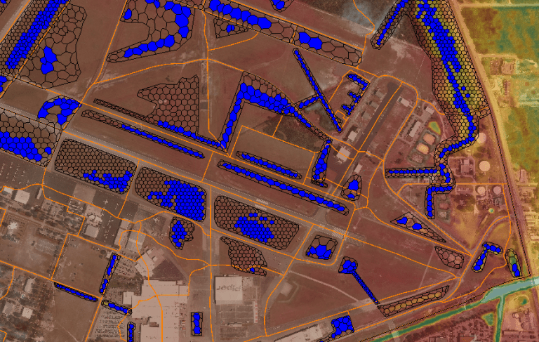 This figure shows a portion of the revised 2006 Vero Beach Regional Airport stormwater master plan, illustrating 25-year and 24-hour St. Johns River Water Management District storm staging results with basin divides, overland flow computational elements and a digital elevation model over an aerial image.
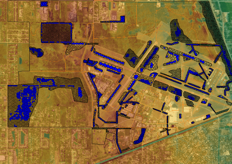 This figure shows the full extent of the model’s area.
The purpose of an SWMP is to make the permitting process as smooth as possible while development progresses. Hanson has been selected to update the airport master plan for Vero Beach, and part of that will be a complete SWMP update to address the stormwater infrastructure system’s condition and capacity to manage runoff during major rainfall events while allowing for proposed development concepts. This will support the development of a stormwater facility improvement plan prior to construction of future projects at the airport. This approach reduces design costs and regulatory burden for future tenants and their project teams, encouraging revenue-producing business at the airport.
For more information about this project, contact Justin Dewey at jdewey@hanson-inc.com.